
Project index
Underwater inspection
VLM360
Reporting platform for sonar-based underwater inspections: GIS maps, sonar mosaics, findings with evidence and field logbooks.
- Client
- Industry
- Aquaculture
- Services
- Custom software and SaaS
- Website
- vlm360.com
The challenge
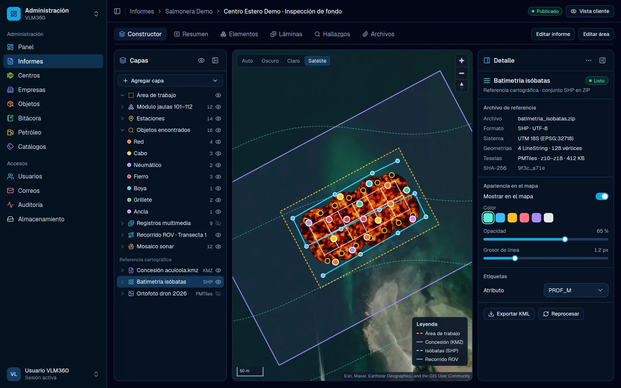
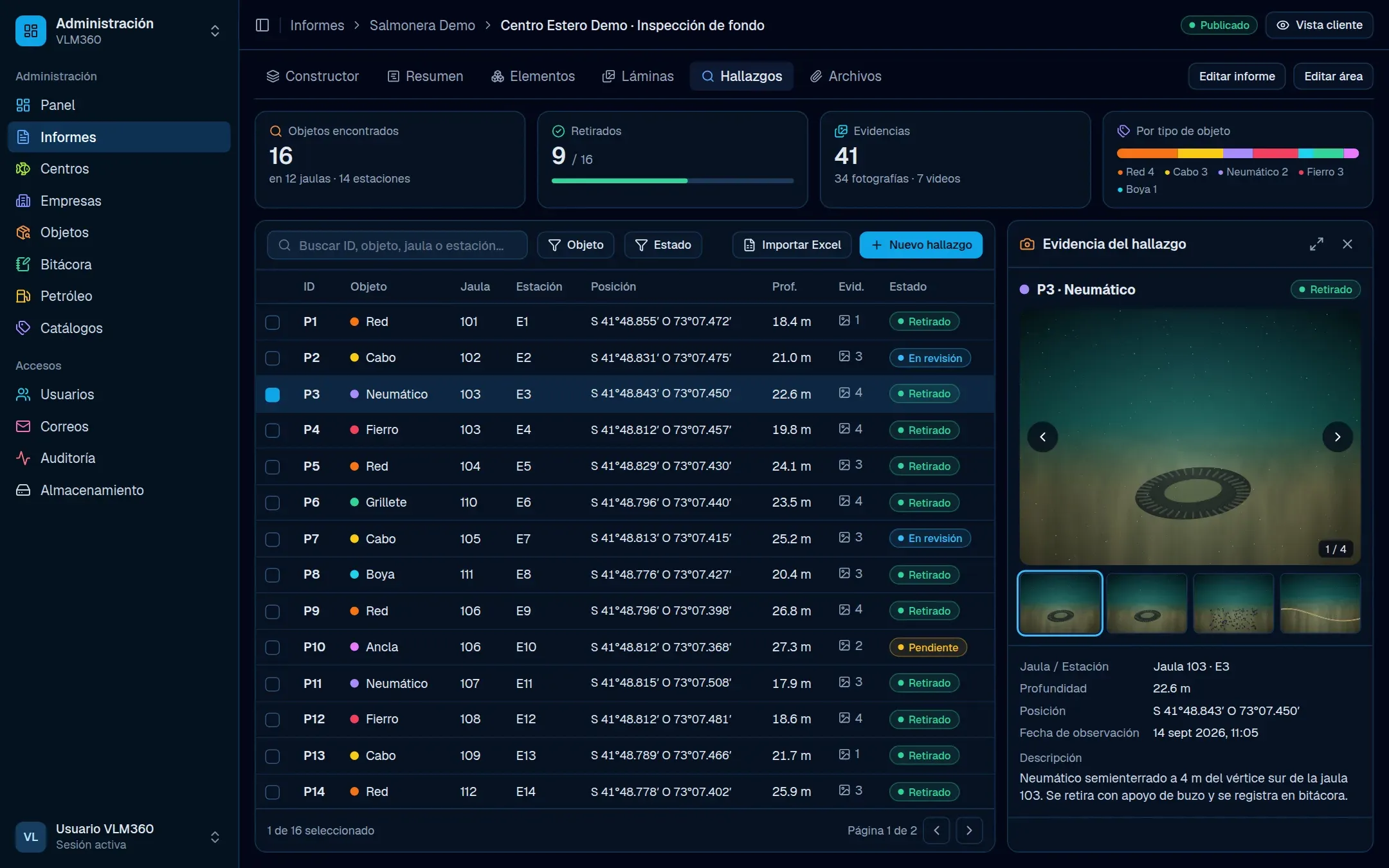
Viejo Lobo de Mar scans the seabed under fish farms with sonar and recovers the objects it finds. Results reached each client in spreadsheets and emails. Now every inspection is a report on a map, and each client sees only what has been published for their sites.
What we built
- Report builder on MapLibre, with cage, station, finding and media layers.
- KML, KMZ and shapefile imports: a Python worker with GDAL and Tippecanoe turns them into PMTiles.
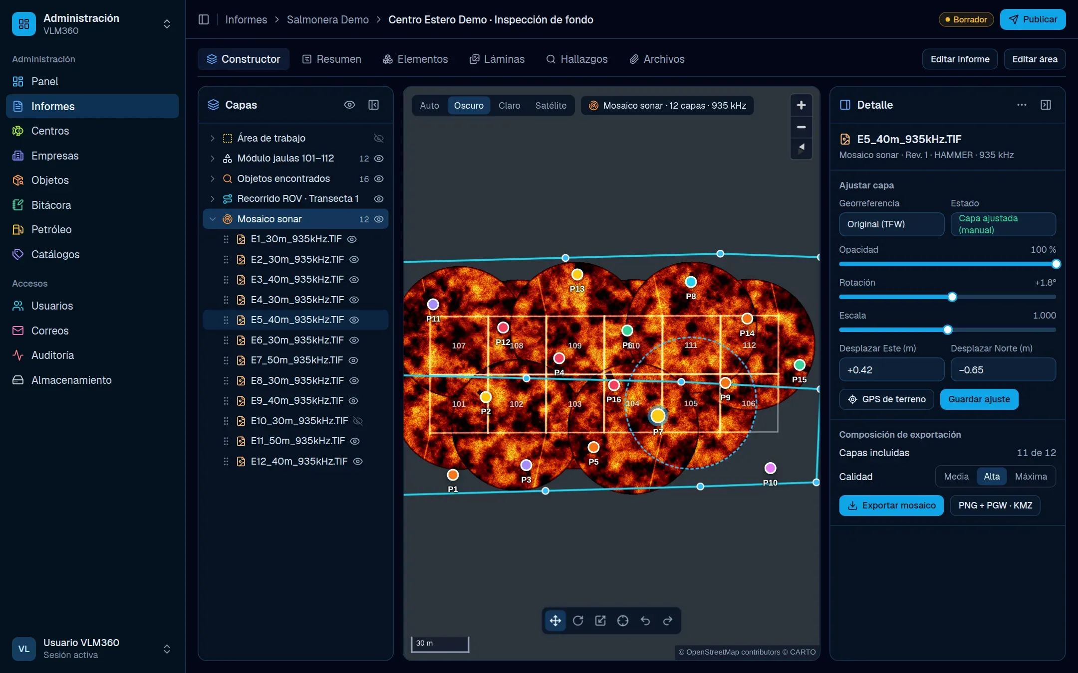
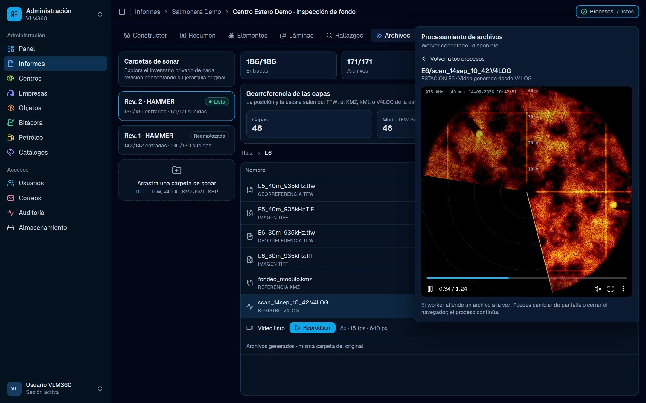
- Sonar mosaic positioned from TFW files, adjustable in opacity, rotation and scale, and exportable.
- V4LOG logs from Tritech sonars rebuilt as polar sweeps and encoded to MP4 with FFmpeg.
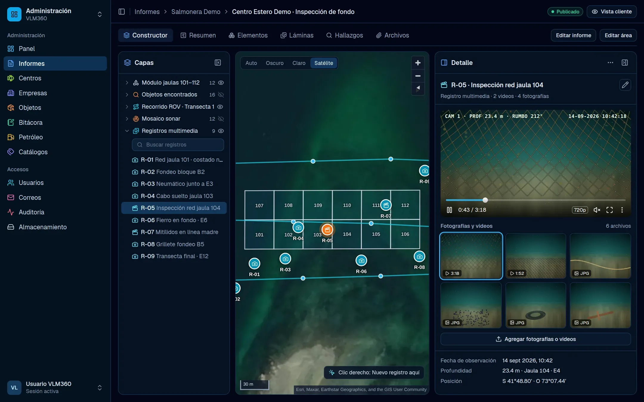
- Findings with an evidence gallery, and videos up to 4 GB converted on the server.
- Offline-capable field logbooks, an approval workflow and a daily PDF report.
- 01
Field
- Sonar Tritech (V4LOG)
- Mosaicos TFW
- KML / KMZ / SHP
- Fotos y videos
- 02
Processing
- Worker Python + GDAL
- Tippecanoe → PMTiles
- FFmpeg → MP4
- Chromium → PDF
- 03
Platform
- Convex (tiempo real)
- Better Auth + 2FA
- Cloudflare R2
- 04
Users
- Constructor de informes
- Cuadrillas en terreno
- Portal del cliente
Screenshots
Technologies
- Interface
- TanStack StartReact 19TanStack QueryTailwind CSS 4shadcn/ui
- Backend
- ConvexPython workersNode workers
- Data
- MapLibre GLPMTilesGDALTippecanoeproj4
- Authentication
- Better Auth2FA
- Services
- FFmpegCloudflare R2ResendChromium (PDF)
- Infrastructure
- GitHub Actions
Next project
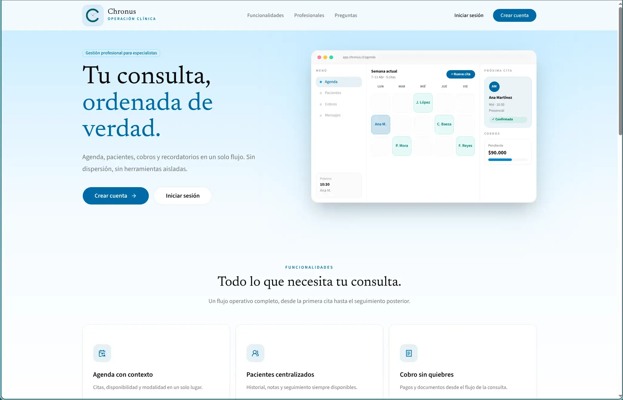
Chronus
Medical scheduling SaaS
Something similar in mind?
Tell us about your case and we'll tell you how we would build it.